5 July 2021
The city and province of Quebec takes its name from an Algonquian language, but as is usual with Indigenous place names, which language is somewhat uncertain. It could come from the Abenaki quililbek or from the Mi’kmaq kepék. Both words mean “place where the waters narrow,” a reference to the width of the St. Lawrence River at the site where Quebec City now stands.
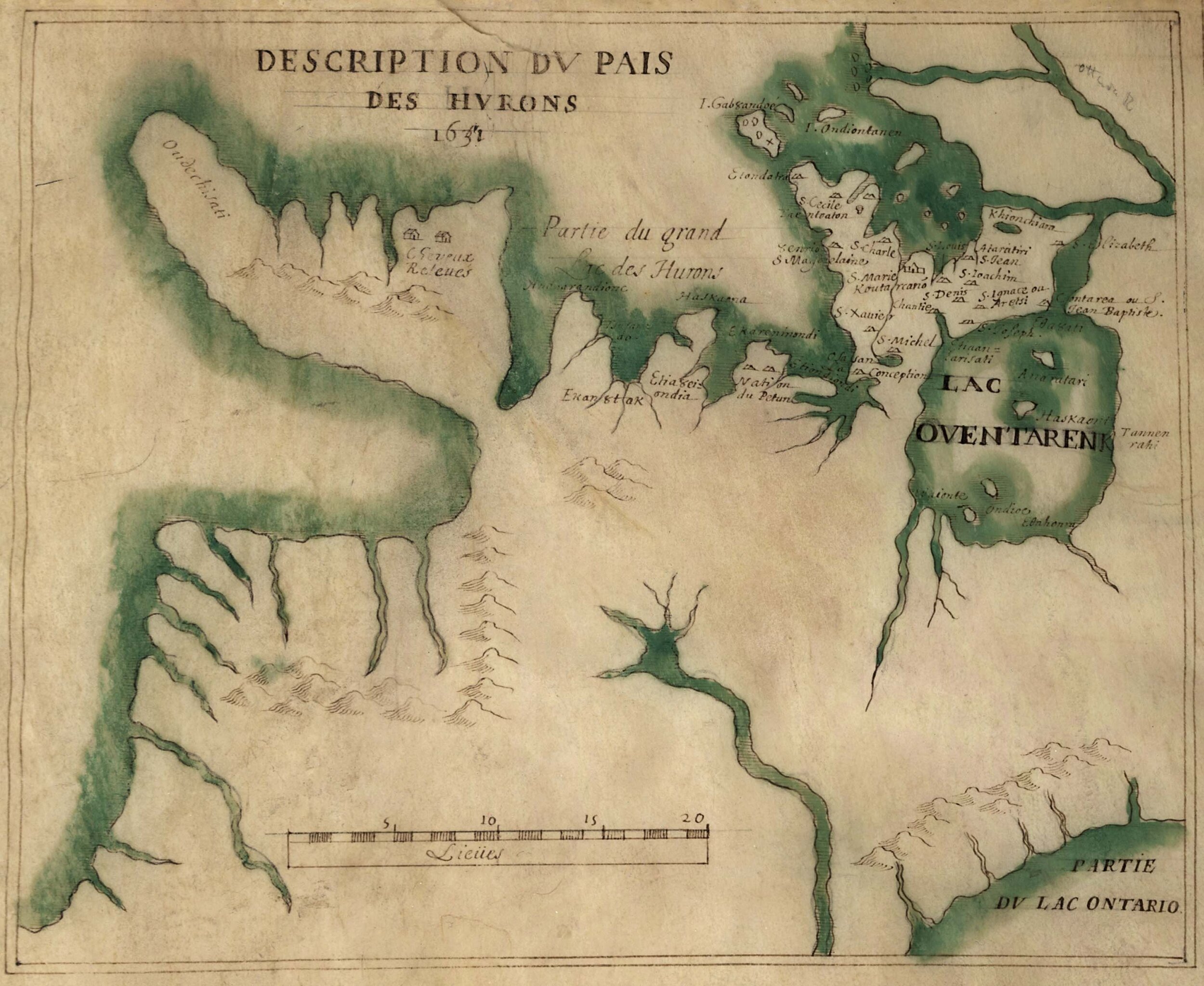
The first European to reach the site was Jacques Cartier in 1534, who found a Huron village called Stadacone there. But when he returned to the site in 1543, the village had been abandoned, the result of war with neighboring Indigenous peoples. Samuel de Champlain founded the city of Quebec on the site in 1608 as the capital of New France, and over the years the name extended to include the surrounding territory.

c.1909 copy of a drawing of Quebec City accompanying Franquelin’s 1688 map. A view of the city as it stood in 1688. In the foreground are ships on the St. Lawrence River and a settlement along the water’s edge. Beyond that is a cliff face, on top of which are the Plains of Abraham and monumental structures.
The name Quebec appears in English writing by 1625. Here’s a passage from Purchas His Pilgrimes of that year, a multi-volume description of places around the world, which makes reference to the original Indigenous meaning of a river narrows:
At the end of the said Ile I saw a fall of water, which fell from a great Mountaine, of the said Riuer of Canada, and on the top of the said Mountaine the ground is leuell and pleasant to behold, although within the said Countries a man may see high Mountaynes which may bee some twenty, or fiue and twenty leagues within the Lands, which are neere the first Sault of Saguenay. We anchored at Quebec, which is a Strait of the said Riuer of Canada, which is some three hundred pases broad: there is at this Strait on the North side a very high Mountayne, which falleth downe on both sides: all the rest is a leuell and goodly Countrey, where there are good grounds full of Trees, as Okes, Cypresses, Birches, Firre-trees and Aspes, and other Trees bearing fruit, and wild Vines: So that in mine opinion, if they were dressed, they would be as good as ours.
Quebec City was captured by the British in 1759 during the French and Indian War (Seven Years War), and the British gained control of French North America. The British originally dubbed the area Lower Canada (as opposed to Upper Canada, located where Ontario is today). The province was also briefly dubbed Canada East from 1840–49, before Lower Canada came back into vogue. The present-day province named Quebec was established in 1867 with the confederation of provinces into the Dominion of Canada.
Sources:
Everett-Heath, John. Concise Oxford Dictionary of World Place Names, sixth ed. Oxford: Oxford UP, 2020. Oxfordreference.com.
Pearce, Margaret Wickens. Coming Home to Indigenous Place Names in Canada (map). Canadian-American Center, University of Maine, 2017.
Purchas, Samuel. Purchas His Pilgrimes, vol. 4 of 5. London: William Stansby, 1625, 1611. Early English Books Online.
Rayburn, Alan. Oxford Dictionary of Canadian Place Names. Don Mills, Ontario: Oxford UP Canada, 1999.
Image credit: Unknown artist, c.1909. Original 1688 map by Jean Baptiste Louis Franquelin. Library of Congress. Public domain image.